AILAI: Cloud-independent crop monitoring service for digital farming
by
Damián Hruban
, Anna Ovesná
, Peter Hapčo
May 30, 2024
The AILAI project aimed to improve crop monitoring by leveraging Sentinel-1 synthetic aperture radar data to predict vegetation indices typically derived from Sentinel-2 multispectral data.

Today, satellites play a crucial role in monitoring vegetation across the globe. The data they provide allows calculating various indicators with insights into crop health, growth stages, and overall agricultural productivity.
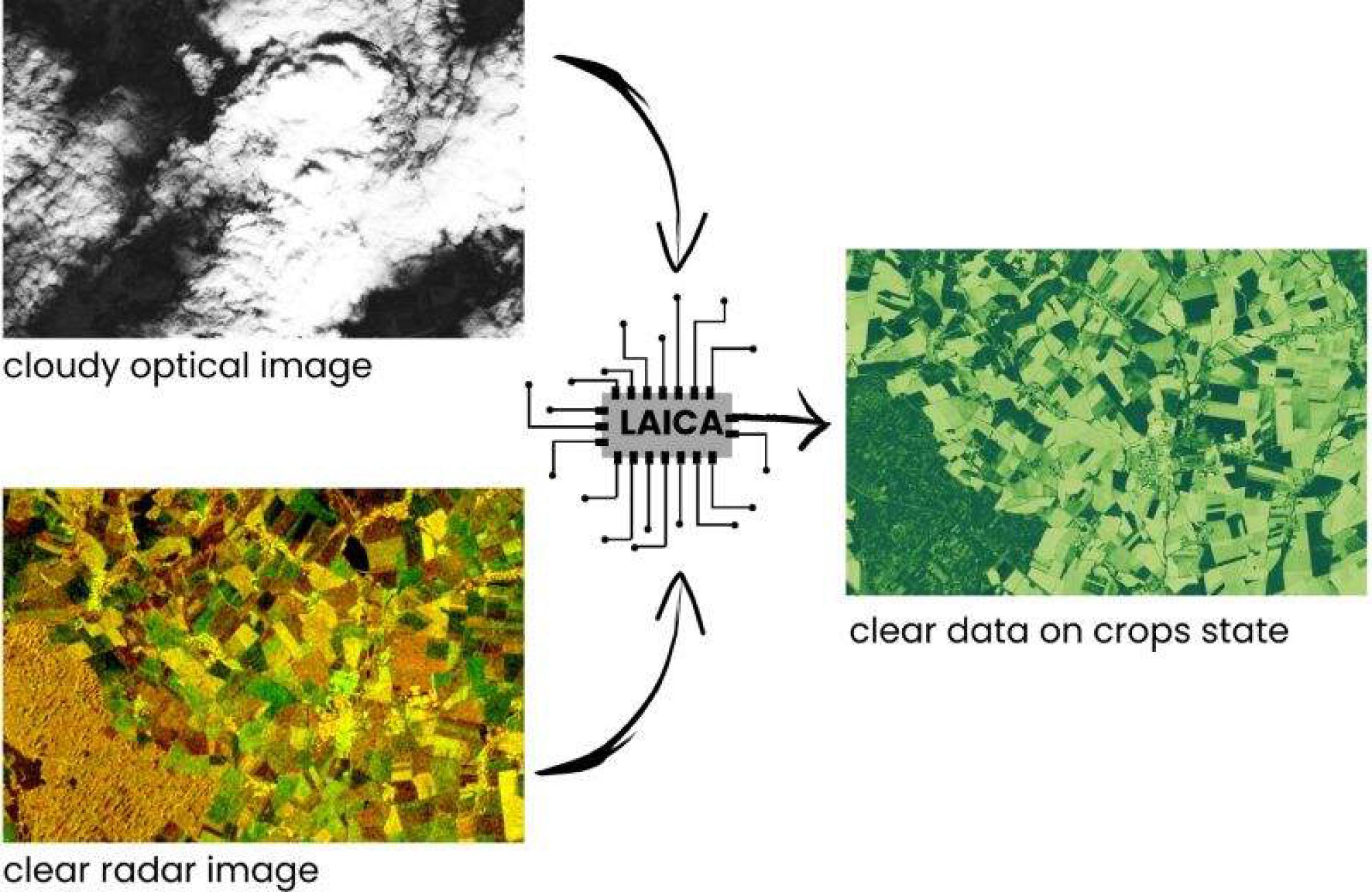
European Space Agency Sentinel-2 mission is providing multispectral satellite data, which is widely used for this purpose, offering critical information on canopy chlorophyll content, water content, and other vital parameters. However, the optical sensor on this mission can be easily obstructed by cloud cover, which limits data availability and accuracy especially in times when much needed.
Fortunately, there is another type of sensor, the synthetic aperture radar carried by ESA’s Sentinel 1 mission. Unlike a multispectral sensor, radar can penetrate clouds. But as radar is a very different sensor from multispectral one, the data from it cannot be used to calculate vegetation indices directly.
Video credit: ESA/ATG medialab
This is where the project AILAI makes a difference. We’ve developed an innovative model that uses radar data from Sentinel-1 to predict vegetation indices, typically derived from multispectral data. This allows us to monitor crops reliably, regardless of weather conditions.
Focusing on winter wheat in Europe, we’ve targeted ten crucial vegetation and moisture indices, such as Leaf Area Index and the Plant Senescence Reflectance Index. These indices, traditionally derived from multispectral Sentinel-2 data, can now be accurately predicted using only radar data. Our best performing LSTM model, which harnesses time series data, achieves prediction errors as low as 0.05. Such level of accuracy is sufficient for practical applications, empowering farmers with reliable, weather-independent insights to optimize their crop management strategies. This enables better decision-making for fertilization, irrigation, and harvest timing, ultimately improving agricultural productivity and sustainability.
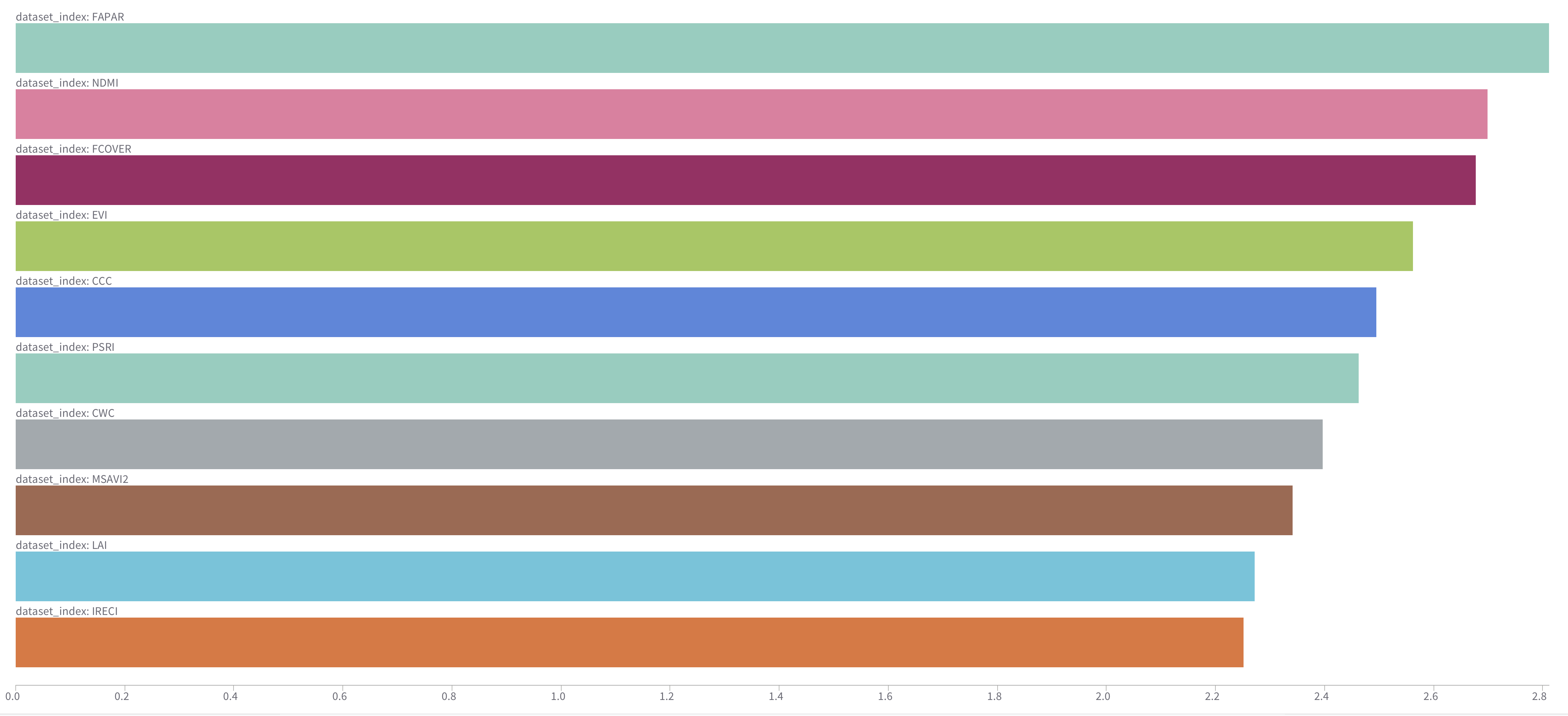 Figure: Ratio of best-performing model for selected indices to the baseline
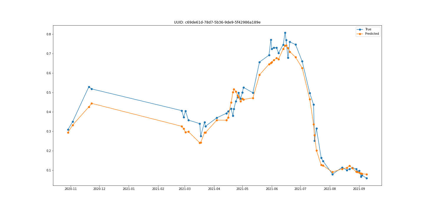 Figure: Example of real EVI values for selected field vs. predicted values using our approach
The AILAI project represents a significant advancement in smart agriculture, ensuring that farmers have the information they need, when they need it.
This project has received funding from the European Union’s Horizon 2020 research and innovation programme under grant agreement No 951847.

Featured articles

AILAI: Cloud-Independent Crop Monitoring Service for Digital Farming
by
Damián Hruban, Anna Ovesná, Peter Hapčo
May 30, 2024
The AILAI project aimed to improve crop monitoring by leveraging Sentinel-1 synthetic aperture radar data to predict vegetation indices typically derived from Sentinel-2 multispectral data.
DynaCrop.space
How to Decrease Inputs and Increase Yields With Field Zonation?
June 30, 2022
Growing prices of fertilizers, supply chains broken with the war in Ukraine, and soaring energy costs put increasing pressure on agronomists this season. As the prices of inputs skyrocket, it is necessary to rethink how much inputs it is necessary to disperse into fields to sustain the current level of yields. The term “decoupling” has […]