References
Meet some of our partners
Project highlights
RegAdapt
Partners: Palacký University Olomouc, Global Change Research Institute CAS, v.v.i., ASITIS s.r.o.
Duration: 2024-2026
The project “Mapping regional landscape priorities for climate change adaptation in the Czech Republic” aims to create a regionalization of the territory in the form of a regional typology of the territory of the entire Czech Republic from the perspective of landscape vulnerability and the urgency of implementing adaptation measures in the landscape. The regional typology will be based on the analysis of an extensive set of input data and is based on the concept of environmental differentiation. The analyses will be carried out on a local scale.
This project is co-financed with state support from the Technology Agency of the Czech Republic within the Environment for Life Programme. This project was financed under the National Recovery Plan from the European Recovery and Resilience Instrument.
More on RegAdapt
LIFE in Salt Marshes
Partners: ENVIROP - Masaryk University, Research Institute for Soil and Water Conservation, Czech Society of Ornithology – South Moravian Branch
Duration: 2023-2029
The aim of the project LIFE in Salt Marshes, with the full title Complex ecological restoration of degraded and disappearing salt marshes of Moravian Pannonia, is to improve the current state of the south Moravian agricultural landscape, which suffers from loss of biodiversity, reduced water retention capacity and poor water quality, in eight wetland sites (506 ha) included in the NATURA 2000 network.
More on LIFE
AILAI
Duration: 2023-2024
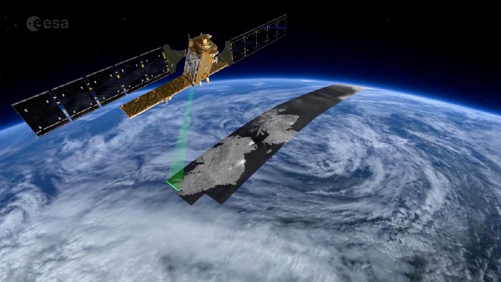
The AILAI project is aimed to improve crop monitoring by leveraging Sentinel-1 synthetic aperture radar data to predict vegetation indices typically derived from Sentinel-2 multispectral data. This innovative approach mitigates the limitations of cloud cover and ensures reliable monitoring under varying weather conditions.
More on AILAI
Orbis
Partners: VZLÚ
Duration: 2023-2024
Modular EO satellite data processing pipeline from raw to analysis-ready data.
More on Orbis
LAICA
Partners: Ximilar
Duration: 2022-2023
Machine learning for uninterrupted weather-independent crop monitoring: SAR-based predictions of spectral data. Multisensor satellite data AI-based fusion of Sentinel 1 and Sentinel 2, for vegetation monitoring and agriculture purposes.
Project “LAICA – Družicové sledování vývoje vegetace metodami umělé inteligence” (CZ.01.1.02/0.0/0.0/21_374/0027239) is co-financed by the European Union from the European Regional Development Fund within the Operational Programme Enterprise and Innovations for Competitiveness under the auspices of the Ministry of Industry and Trade of the Czech Republic.
More on LAICA
Further projects
| Name | Partners | Duration | Description |
| UpGreen | ASITIS, Atregia | 2022-2023 | ESA project for EO processing pipeline design and product design of UpGreen service: Assessment, prediction and optimal design of urban vegetation |
| EuroGEO e-shape | 37 companies/academic institutions, powered by EuroGEO | 2022-current | A Horizon 2020 project on improving user uptake of EO and other spatial data. World from Space was part of the Food Security & Sustainable Agriculture showcase and focuses on service uptake in the wider food production value chain in line with regenerative agriculture and farm-to-fork strategy. |
| TAVAP | - | 2022-2023 | Plant phenology, timing, and variable rate application prescription maps for precision agriculture. |
| AMBIC | Czech Aerospace Research Centre, SAB Aerospace, PEKASAT SE | 2021-2023 | An “Ambitious project” from ESA and the Ministry of Transport to operate a Czech microsatellite mission. Designing a national high-resolution EO satellite with 2 optical payloads. World from Space is responsible for EO data processing and interpretation. |
| OptiAgroll | VUMOP, Mendel University, Rostěnice Farm | 2021-2024 | A project backed by the National Agricultural Research Agency on mapping of soil conditions including moisture changes to stabilize yields on unbalanced farmland. World from Space focused on Sentinel-1 and Sentinel-2-based product optimization for the mentioned use case. |
| EUSPA FWC | Alpha Consult | 2021-2024 | Consulting support to space downstream market development team of the European Union Agency for the Space Programme. |
| NAZV: Soil conditions | VÚMOP | 2021-2024 | Effective mapping of soil conditions and soil moisture to stabilize yields. National Agency for Agricultural Research (2021-2024). |
| Copernicus Incubator: DynaCrop | - | 2020-2021 | Go-to-market strategy for the DynaCrop product. |
| EO in support for International Development | Everis ADS, Greenspin, Geomer | 2019-2022 |
|
| TAČR: EO DynaCrop | - | 2019-2019 | Technology Agency of the Czech Republic project of AI drought and vegetation dynamics monitoring for farm management software. H2020 SME Instrument Seal of excellence program |
| ESA BIC: Drought Measure | - | 2019-2021 | Assessment of a commercial drought assessment service for cities, regions, insurance companies, and farmers in the EU. |
| ESA BIC: Drought Measure | - | 2019-2021 | Assessment of a commercial drought assessment service for cities, regions, insurance companies, and farmers in the EU. |
World from Space in Press
Forbes
Sledujeme Zemi z vesmíru a děláme z ní lepší místo, hlásí brněnský startup — Forbes
February 5, 2023
Zemědělství budoucnosti bude spojené s kosmickým průmyslem, který pomůže udělat z naší planety lepší místo.
seznamzpravy.cz
Nejlepší český kosmický startup pomáhá zemědělcům proti suchu přes družice - Seznam Zprávy
Největší český festival vesmírných aktivit Czech Space Week v Praze v úterý vyhlašoval i soutěž o nejlepší kosmický startup z Evropy. Do finále …
CzechCrunch
Díky družicím pomáhá zemědělcům i městům. Český World from Space mění parky doma i životy v Nigérii
August 11, 2021
Vědí, jak se daří plodinám, kdy sít, kdy sklízet. Vidí do budoucnosti. Technologie World from Space výrazně zvyšují produktivitu zemědělství.
Kurzy.cz
Družicová data vyhodnocuje brněnský startup - farmaření s nadhledem | Kurzy.cz
Brněnský FARMAŘENÍ S NADHLEDEM: DRUŽICOVÁ DATA VYHODNOCUJE BRNĚNSKÝ STARTUP Brněnský startup World from Space díky vyhodnocování družicových dat …


